
Scottsdale → Tonto National Forest via Bush Highway
Fully paved · Slingshot-appropriate roads only
scottsdaleslingshots.com · /adventures/tonto-national-forest-slingshot-drive
Tonto National Forest
Half day (4–5 hrs) or full day · ~80 miles round trip · 2–3 hrs with stops
Scottsdale → Tonto National Forest · ~80 miles round trip
Tonto National Forest
Canyon country. Salt River. Open desert roads. The Bush Highway is one of the best open-road driving stretches in the Phoenix area — and it's 30 minutes from Old Town.
Check Availability on TuroDistance
~80 miles round trip
Drive Time
2–3 hrs with stops
Rental Rec.
Half day (4–5 hrs) or full day
Road Type
Fully paved — all roads suitable for the Slingshot
Difficulty
Easy — smooth paved roads throughout
Best Season
Year-round; Oct–April ideal; summer mornings are beautiful
Canyon Country. Salt River. Open Desert Roads.
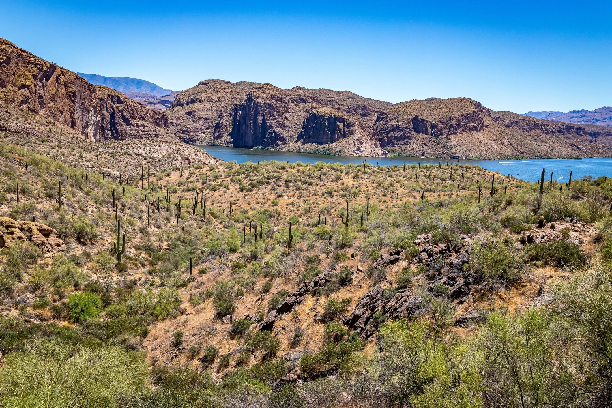
Tonto National Forest covers nearly 3 million acres of Arizona desert, canyon, and mountain wilderness — and the Bush Highway (AZ-87) cuts right through the heart of it. This is one of the best open-road driving stretches in the Phoenix area: wide lanes, saguaro cactus on both sides, the Salt River alongside, and almost no traffic.
The route from Old Town Scottsdale takes you northeast on Shea Boulevard through the McDowell Mountains, then south on the Bush Highway through the Tonto National Forest. The Mazatzal Mountains rise to the north, the Salt River winds through the canyon below, and wild horses roam the corridor — sightings are common in the early morning.
Every mile of this route is paved and appropriate for the Polaris Slingshot. No dirt roads, no off-road sections — just open desert scenery from an open cockpit.
The Route
Starting point: Old Town Scottsdale (exact pickup address provided after Turo booking)
Scottsdale → Shea Blvd East (AZ-87 North)
Head northeast on Shea Boulevard through the McDowell Mountains. Pick up AZ-87 (Bush Highway) heading south into the Tonto National Forest. About 20 miles, 25 minutes.
Bush Highway — Tonto National Forest
The Bush Highway is one of the best open-road drives in the Phoenix area. Saguaro cactus lines both sides of the road, the Salt River winds through the canyon below, and the Mazatzal Mountains rise to the north. Watch for wild horses along the Salt River corridor.
Salt River Wild Horse Area
Wild horses roam the Salt River corridor near the Bush Highway. Sightings are common in the early morning and late afternoon. Pull over safely and watch from a distance.
Optional: Continue to Saguaro Lake
The Bush Highway connects directly to Saguaro Lake — add the lake to your route for a longer half-day adventure. The marina has a restaurant and boat rentals.
Return to Scottsdale
Return north on the Bush Highway toward Scottsdale. The drive back is as good as the drive out — wide lanes, desert scenery, and almost no traffic.
Best Stops
Bush Highway Open Road
One of the best open-road driving stretches in the Phoenix area. Wide lanes, desert scenery, the Salt River alongside — and almost no traffic. The Slingshot was made for this road.
Salt River Wild Horse Area
Wild horses roam the Salt River corridor near the Bush Highway. Sightings are common in the early morning and late afternoon. Pull over safely and watch from a distance.
Mazatzal Mountains Views
The Mazatzal Mountains — a dramatic wilderness range — are visible from the Bush Highway. Best in morning light when the canyon walls catch the early sun.
Saguaro Lake (optional extension)
The Bush Highway connects directly to Saguaro Lake. Add the lake to your route for a longer adventure — the marina has a restaurant and the Dolly Steamboat runs narrated lake cruises on weekends.
What You Need to Know
All Paved — Slingshot Appropriate
Every road on this route is paved and maintained. No dirt sections, no off-road driving. The Polaris Slingshot handles this route perfectly in any weather.
Fuel
Fuel up in Scottsdale before departure — use premium unleaded, 91 octane or higher. The full loop is about 80 miles — well within a single tank. There is no fuel on the Bush Highway.
Water
Carry water — the Slingshot has no roof and Arizona sun is intense. There are no services on the Bush Highway itself.
Cell Service
Good cell coverage on most of this route. The Bush Highway has occasional dead spots but nothing extended. Standard navigation apps work reliably.
Wild Horses
Wild horses are common along the Salt River corridor. If you see horses on or near the road, slow down and give them space. Do not approach or feed them.
Suggested Half-Day Itinerary
7:00 AM
Pick up Slingshot in Old Town Scottsdale
7:15 AM
Head northeast on Shea Blvd, pick up Bush Highway south
7:45 AM
Bush Highway — Tonto National Forest open road
8:00 AM
Salt River corridor — watch for wild horses
8:30 AM
Optional: continue to Saguaro Lake Marina
9:30 AM
Bush Highway scenic return toward Scottsdale
10:30 AM
Return to Old Town Scottsdale
Book Your Tonto National Forest Drive
Check real-time availability on Turo. Protection plans available at checkout. Old Town Scottsdale pickup.
Check Availability on Turo5.0★ · 47+ Five-Star Reviews