
Scottsdale → Sedona via I-17 & AZ-179
Fully paved · Slingshot-appropriate roads only
Long route — use the leg links in the toolbar to open each section in Maps.
scottsdaleslingshots.com · /adventures/sedona-slingshot-drive
Sedona Red Rock Drive
Full day (8–10 hrs) · ~120 miles round trip · 2–2.5 hrs each way
Scottsdale → Sedona · ~120 miles round trip
Sedona Red Rock Drive
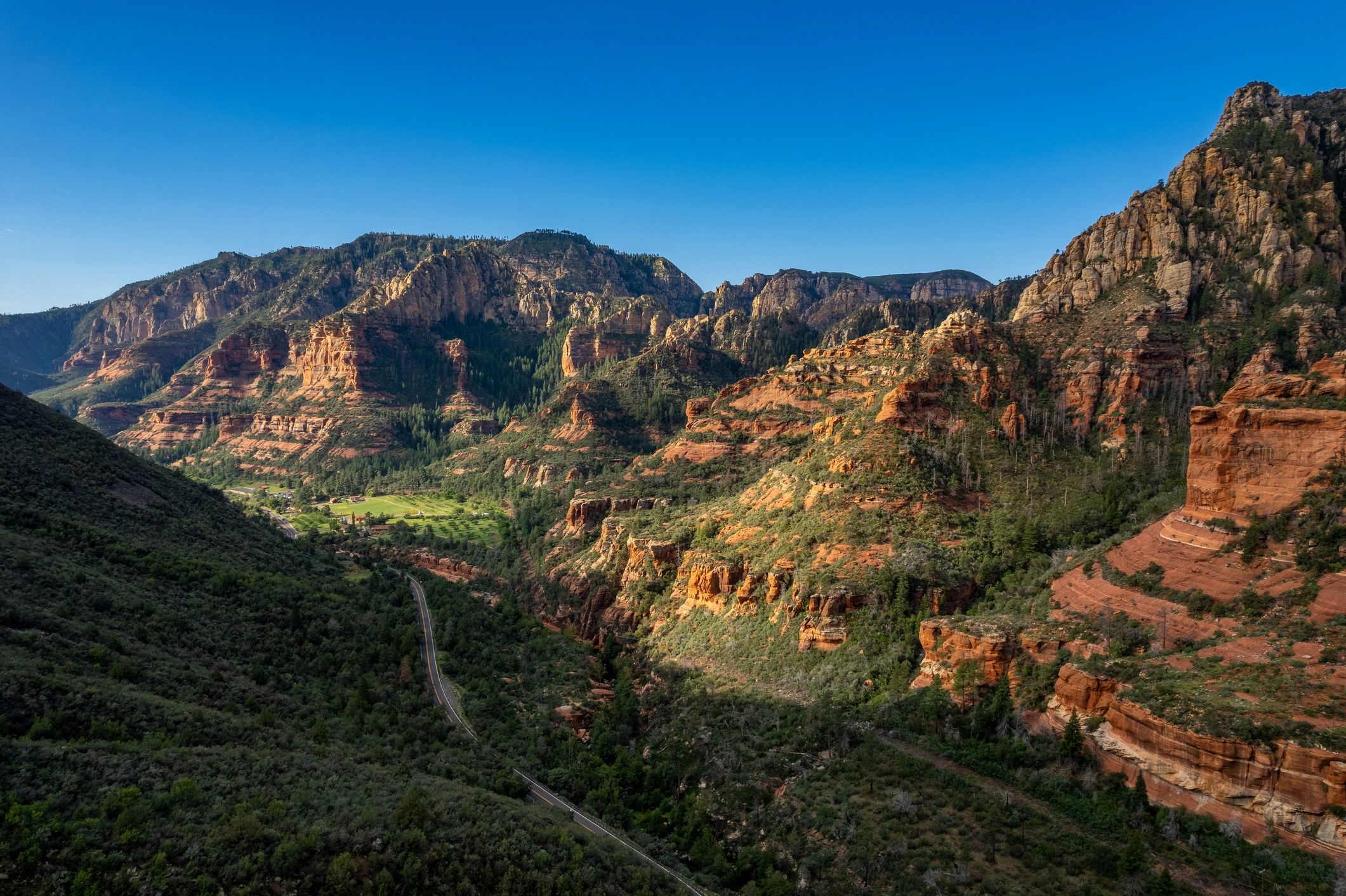
Arizona's most iconic scenic corridor — red rock spires, Oak Creek Canyon, and one of the most photographed landscapes in the American Southwest.
Check Availability on TuroDistance
~120 miles round trip
Drive Time
2–2.5 hrs each way
Rental Rec.
Full day (8–10 hrs)
Road Type
Paved highway, all-weather
Difficulty
Easy — suitable for all drivers
Best Season
Oct–May (avoid summer midday heat)
Why Sedona Is the Ultimate Slingshot Drive
The drive from Scottsdale to Sedona on AZ-179 and US-89A is one of the most visually rewarding roads in North America. You leave the Sonoran Desert floor, climb through the Verde Valley, and arrive in a landscape of 300-million-year-old red sandstone formations that rise 1,000 feet above the canyon floor.
In a Slingshot, the experience is visceral. The open cockpit puts you directly in the landscape — no glass between you and the canyon walls, no roof blocking the sky. The AZ-179 corridor through the Village of Oak Creek is smooth, well-maintained, and lined with pullouts for photography. Oak Creek Canyon on US-89A north of Sedona is a winding descent through ponderosa pine and red rock that rewards every corner.
This is the route we recommend most often to first-time renters. It's accessible, the roads are excellent, and the payoff is immediate.
The Route
Starting point: Old Town Scottsdale (exact pickup address provided after Turo booking)
Scottsdale → Carefree Highway
Head north on Scottsdale Road or the 101 to I-17 North. The drive through north Phoenix and the desert foothills takes about 30 minutes.
I-17 North → AZ-179 (Exit 298)
Take I-17 north through the Verde Valley. Exit at AZ-179 (Sedona/Village of Oak Creek). This is where the red rock landscape begins — Bell Rock and Courthouse Butte appear immediately on your left.
AZ-179 Scenic Corridor
The 7-mile stretch of AZ-179 from the Village of Oak Creek to Sedona proper is designated a National Scenic Byway. Multiple pullouts allow photography of Bell Rock, Courthouse Butte, and Cathedral Rock. Speed limit is 35–45 mph — take your time.
Sedona Town Center
Park near Tlaquepaque Arts Village or the Sedona Visitor Center. Lunch options are plentiful — Elote Cafe, Mariposa Latin Inspired Grill, and The Hudson are popular choices.
Optional: Oak Creek Canyon (US-89A North)
If time allows, drive US-89A north through Oak Creek Canyon toward Flagstaff. The 12-mile canyon section is one of the most dramatic roads in Arizona — tight switchbacks, creek crossings, and sheer canyon walls. Turn around at Slide Rock State Park or continue to Flagstaff.
Return to Scottsdale
Return via AZ-179 to I-17 South. Alternatively, loop back via US-89A to Cottonwood and I-17 for variety.
Best Photo Stops
Bell Rock Pathway
Easy 1-mile trail with Bell Rock and Courthouse Butte as backdrop. Best light: morning.
Cathedral Rock Crossing
Park at the Red Rock Crossing trailhead on Back O' Beyond Road. The reflection of Cathedral Rock in Oak Creek is one of the most photographed scenes in Arizona.
Airport Mesa Overlook
Short drive up Airport Road gives a 360° panoramic view of the entire Sedona basin. Sunset here is exceptional.
Slide Rock State Park
Natural rock water slides in Oak Creek Canyon. Worth a stop even if you don't swim — the canyon scenery is stunning.
Tlaquepaque Arts Village
Spanish colonial architecture, galleries, and restaurants in the heart of Sedona. Good lunch stop.
What You Need to Know
Red Rock Pass
Parking at most Sedona trailheads requires a Red Rock Pass ($5/day or $15/week). Purchase at trailhead kiosks or online at recreation.gov. Some lots are free — check signage.
Fuel
Fill up in Scottsdale before departure — use premium unleaded, 91 octane or higher. Sedona has fuel stations but prices run higher than the Valley. The round trip is approximately 120 miles — well within a single tank.
Traffic
Sedona is one of Arizona's most visited destinations. AZ-179 can back up on weekend afternoons, especially in spring. Arrive before 10am or after 3pm to avoid the worst congestion.
Weather
Sedona sits at 4,350 feet elevation — noticeably cooler than Scottsdale. Bring a light jacket even in spring. Summer monsoon season (July–September) brings afternoon thunderstorms; check forecasts before heading into Oak Creek Canyon.
Cell Service
Good throughout the AZ-179 corridor and Sedona town. Oak Creek Canyon has gaps — download offline maps before you go.
Road Conditions
AZ-179 and US-89A are well-maintained paved highways suitable for the Slingshot year-round. No unpaved sections on the main route. Oak Creek Canyon can close temporarily after heavy rain or rockfall — check ADOT alerts at az511.gov.
Suggested Full-Day Itinerary
7:00 AM
Pick up Slingshot in Old Town Scottsdale
7:15 AM
Fuel up and head north on I-17
9:00 AM
Arrive Village of Oak Creek — Bell Rock Pathway walk (45 min)
10:00 AM
Drive AZ-179 scenic corridor with stops at Cathedral Rock Crossing
11:00 AM
Sedona town center — explore Tlaquepaque, coffee stop
12:30 PM
Lunch in Sedona
2:00 PM
Drive Oak Creek Canyon (US-89A North) to Slide Rock State Park
3:30 PM
Airport Mesa overlook for afternoon light
4:30 PM
Begin return to Scottsdale via AZ-179 / I-17
6:30 PM
Return Slingshot in Old Town Scottsdale
Book Your Sedona Drive
Check real-time availability on Turo. Protection plans available at checkout. Old Town Scottsdale pickup.
Check Availability on Turo5.0★ · 47+ Five-Star Reviews