
Scottsdale → Four Peaks via Bush Highway
Fully paved · Slingshot-appropriate roads only
scottsdaleslingshots.com · /adventures/four-peaks-slingshot-drive
Four Peaks Scenic Route
Full day (6–8 hrs) · ~100 miles round trip · 2.5–3.5 hrs with stops
Scottsdale → Four Peaks · ~100 miles round trip
Four Peaks Scenic Drive
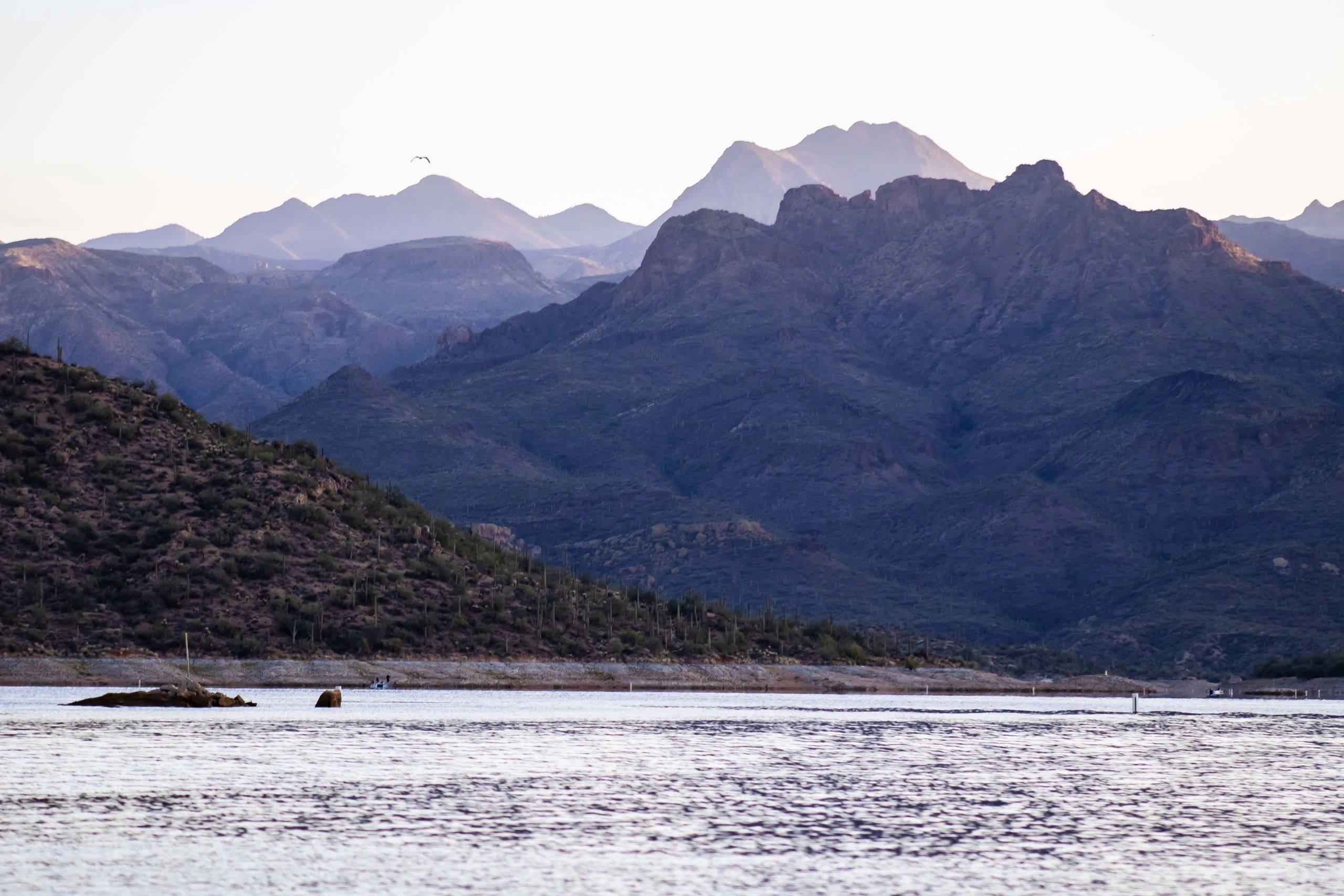
Scottsdale's dramatic mountain backdrop — up close. Bush Highway, Saguaro Lake, and the Tonto National Forest wilderness.
Check Availability on TuroDistance
~100 miles round trip
Drive Time
2.5–3.5 hrs with stops
Rental Rec.
Full day (6–8 hrs)
Road Type
Paved highway throughout
Difficulty
Moderate — mountain curves, some elevation
Best Season
Oct–May; cooler than Valley by 10–15°F
The Wilderness Behind Scottsdale's Skyline
Four Peaks is the jagged mountain silhouette visible from almost anywhere in the Scottsdale Valley — four distinct summits rising to 7,657 feet above the desert floor. The drive to the base of the wilderness follows the Bush Highway (AZ-87 / SR-87) north through the Salt River Recreation Area and Tonto National Forest, passing Saguaro Lake along the way.
The Bush Highway is one of the most scenic paved roads in the Phoenix area — a two-lane road that follows the Salt River through desert canyon country, with saguaro-covered hillsides, river crossings, and the Four Peaks rising ahead. The road is smooth and well-maintained throughout.
Note: The Four Peaks Wilderness itself is accessible only by foot or high-clearance 4WD on unpaved forest roads. The Slingshot drive takes you to the base of the wilderness — the views of the peaks from the Bush Highway and Saguaro Lake are exceptional without leaving the pavement.
The Route
Starting point: Old Town Scottsdale (exact pickup address provided after Turo booking)
Scottsdale → Mesa (US-60 or 202 East)
Head east toward Mesa on the 202 or US-60. About 20 miles, 25 minutes.
Mesa → Bush Highway (AZ-87 North)
Take AZ-87 (Beeline Highway) north from Mesa. The road climbs out of the Valley and enters the Tonto National Forest. The Salt River Recreation Area begins about 15 miles north of Mesa.
Bush Highway / Salt River Recreation Area
The Bush Highway follows the Salt River through desert canyon country. Multiple pullouts for river views and photography. Wild horses are occasionally seen in this area.
Saguaro Lake
Turn right on Bush Highway (the road splits — follow signs to Saguaro Lake). The lake is a 10-mile reservoir surrounded by saguaro-covered cliffs. The marina has a restaurant, boat rentals, and a small store.
Four Peaks Viewpoints
Continue north on AZ-87 past Saguaro Lake for the best views of Four Peaks. The peaks are most dramatic from the highway between miles 195 and 205. Pull over at any of the scenic viewpoints.
Return to Scottsdale
Return south on AZ-87 to Mesa and back to Scottsdale. Alternatively, continue north to Payson for a longer adventure.
Best Stops
Salt River Recreation Area
The Bush Highway through the Salt River area is one of the most scenic drives near Phoenix. Wild horses, river crossings, and saguaro-covered canyon walls.
Saguaro Lake Marina
Restaurant, boat rentals, and the best close-up view of the lake. The Saguaro Lake Ranch offers horseback rides and a lakeside restaurant.
Four Peaks Viewpoints
The peaks are visible from much of the drive but are most dramatic from AZ-87 north of Saguaro Lake. Morning light on the east face is exceptional.
Butcher Jones Beach
A popular swimming and picnic area on Saguaro Lake. Requires a Tonto Pass for parking.
What You Need to Know
Tonto Pass
Required for parking at Saguaro Lake and most Salt River Recreation Area sites. $8/day or $20/week. Purchase at entrance kiosks or online at recreation.gov.
Fuel
Fuel up in Scottsdale or Mesa before heading north — use premium unleaded, 91 octane or higher. The Bush Highway has no fuel stations. The nearest fuel north of Mesa is in Payson (~60 miles north).
Wild Horses
The Salt River wild horse herd is frequently seen along the Bush Highway and river crossings. Drive slowly in this area — horses can appear on the road.
Weather
Four Peaks elevation is 7,657 feet — significantly cooler than Scottsdale. The drive to the base is at 1,500–2,500 feet, but bring a jacket for spring and fall mornings.
Cell Service
Good on AZ-87 and at Saguaro Lake. Limited in some canyon sections of the Bush Highway.
Suggested Full-Day Itinerary
7:30 AM
Pick up Slingshot in Old Town Scottsdale
7:45 AM
Head east to Mesa, then north on AZ-87
8:45 AM
Enter Salt River Recreation Area — watch for wild horses
9:15 AM
Saguaro Lake — marina stop, lake views
10:30 AM
Continue north on AZ-87 — Four Peaks viewpoints
11:30 AM
Butcher Jones Beach or Saguaro Lake Ranch for lunch
1:00 PM
Begin return south on AZ-87
2:30 PM
Return Slingshot in Old Town Scottsdale
Book Your Four Peaks Drive
Check real-time availability on Turo. Protection plans available at checkout. Old Town Scottsdale pickup.
Check Availability on Turo5.0★ · 47+ Five-Star Reviews